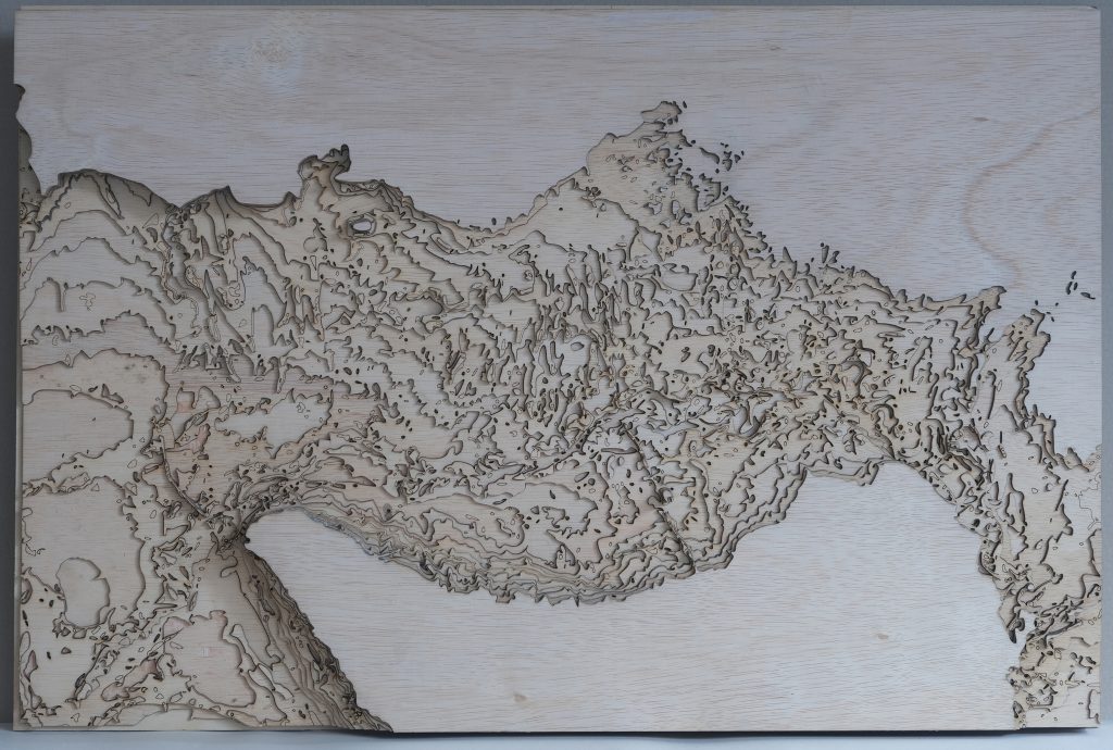
Testmodel for a larger model for IJssel flooding ( overstromingsmodel Ijssel). Lasercut, topographycally correct model ( plywood). 14 layers glued on top of each other, every layer represents 1 m elevation. It is a nice looking model, but water will not run properly (compare problems with Lego model). The dikes and levees are missing, because of the small scale. Visible are the railtrack near A1 ( Deventer) and highway A50 (Zwolle) with have large dikes.
The river dune formation as well as wind dunes and other geomorfological details are nicely visible and because of the 3-dimensionality. This offers interesting discoveries and insights in the structure which is otherwise hard to read from a map for non-geographers.
voordelen
- insight in geomorphology
- inviting to look at, surprising
- esthetically pleasing
- tijdrovende bouw, met name omdat geen snelle seriematige productie kan worden uitgevoerd
nadelen
- statisch, niet geschikt voor interactie, niet geschikt voor water
mogelijk gebruik
- illustratie overall opbouw van een gebied
- ruimtelijke samenhang, relief goed zichtbaar
- goed bruikbaar bij detail modellen, bv in combi met lego of schuimsnij-modellen